- The exhibition opens today and can be viewed free of charge at the Clock Building until November 9th. Visiting hours are from 11 a.m. to 7 p.m., Monday to Sunday
- The exhibition runs through the names of streets and squares in Valencia and its maritime neighbourhoods
- Visitors can discover interesting facts about the street names, such as the fact that Calle del Mar (Sea Street) got its name because it was a direct route from the city centre to the sea
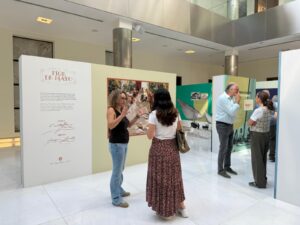
Valencia, 2 October 2025 – Valenciaport’s exhibition “El Marítim, a peu de carrer” opens its doors to the public today. The exhibition, which is free to enter, aims to immerse residents and visitors in the living memory of the “poblats de la mar”, Valencia’s seaside neighbourhoods, whose identity has always been linked to the Mediterranean and which fill the city’s streets.
The Clock Building is hosting this exhibition, which will be open until 9 November. Visiting hours are from 11 a.m. to 7 p.m., Monday to Sunday. The exhibition’s opening was attended by its curator, art historian Ester Medán, a specialist in the history of architecture, engineering and public works.
Medán explained that the exhibition takes visitors on a journey through panels with text, historical images, objects and memorabilia related to fishing, trade, coastal defence and leisure, as factors that have transformed the port community and the city of Valencia itself, whose street map reflects part of the maritime and port history.
In this sense, as in any city, the names of streets and squares are a living reflection of its past. In this case, the exhibition collects and highlights the history of some of the current place names linked to the Maritime District of Valencia, formed by the annexation at the end of the 19th century of neighbourhoods such as Malva-rosa, Poble Nou de la Mar, Cap de França, Cabanyal, Canyamelar, Vilanova del Grau and Natzaret.
From Cabanyal to Porta de la Mar
The exhibition explains the origin of the name of neighbourhoods such as Cabanyal, which dates back to 1422 and is due to its characteristic fishermen’s huts and shacks. It also tells the story of the nearby neighbourhood of Natzaret, originally created to provide a secluded place for the quarantine of sailors and goods, although over time it abandoned this function.
The centre of Valencia also has maritime vestiges, with places such as Calle del Mar, named it this way because it was a direct route from the city centre to the sea, passing close to the old Customs House, and marking the exit to the outside world. Porta de la Mar, meanwhile, was originally a gate in the medieval wall that connected the city centre directly to the port of Grao.
The exhibition also reveals interesting facts, such as that the current Cirilo Amorós Street was originally called Puerto Street and served as an alternative to Avenida del Puerto, connecting the Russafa neighbourhood with the sea.
The port also plays a leading role
The history of the Port of Valencia is another of the protagonists of “El Marítim, a peu de carrer”. Visitors can discover how Valencia, since its origins, has been a commercial city and a meeting point for merchants from all over the world, and how it has evolved to become a transoceanic port that is now a benchmark for global markets.
Specifically, the exhibition traces the attempts, technical challenges and major projects that, from the 17th century to the second half of the 19th century, made it possible to transform a harbour with no natural shelter into a modern and safe infrastructure. A story of collective effort in which names such as Juan Bautista Llovera, Luis Dicenta, Just Vilar, Manuel Maese or Fausto Elio come to life again, reminding visitors that they are still engraved in the streets of Valencia today.